Bolivia (Plurinational State of Bolivia)
 |
 |
| Flag of Bolivia | |
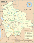
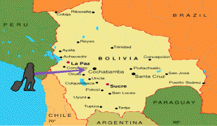
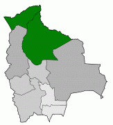
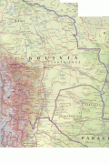
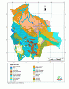
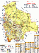
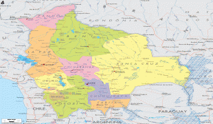
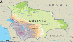
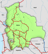
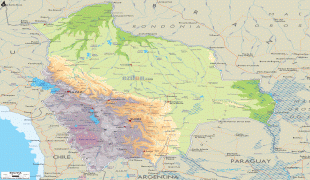
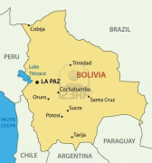
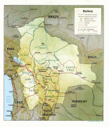
The sovereign state of Bolivia is a constitutionally unitary state, divided into nine departments. Its geography varies from the peaks of the Andes in the West, to the Eastern Lowlands, situated within the Amazon basin. One-third of the country is within the Andean mountain range. With 1098581 km2 of area, Bolivia is the fifth largest country in South America, after Brazil, Argentina, Peru, and Colombia (and alongside Paraguay, one of the only two landlocked countries in the Americas), the 27th largest in the world, the largest landlocked country in the Southern Hemisphere, and the world's seventh largest landlocked country, after Kazakhstan, Mongolia, Chad, Niger, Mali, and Ethiopia.
The country's population, estimated at 12 million, is multiethnic, including Amerindians, Mestizos, Europeans, Asians, and Africans. Spanish is the official and predominant language, although 36 indigenous languages also have official status, of which the most commonly spoken are Guarani, Aymara, and Quechua languages.
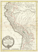
Before Spanish colonization, the Andean region of Bolivia was part of the Inca Empire, while the northern and eastern lowlands were inhabited by independent tribes. Spanish conquistadors arriving from Cusco and Asunción took control of the region in the 16th century. During the Spanish colonial period Bolivia was administered by the Real Audiencia of Charcas. Spain built its empire in large part upon the silver that was extracted from Bolivia's mines. After the first call for independence in 1809, 16 years of war followed before the establishment of the Republic, named for Simón Bolívar. Over the course of the 19th and early 20th century Bolivia lost control of several peripheral territories to neighboring countries including the seizure of its coastline by Chile in 1879. Bolivia remained relatively politically stable until 1971, when Hugo Banzer led a CIA-supported coup d'état which replaced the socialist government of Juan José Torres with a military dictatorship headed by Banzer. Banzer's regime cracked down on left-wing and socialist opposition and other forms of dissent, resulting in the torture and deaths of a number of Bolivian citizens. Banzer was ousted in 1978 and later returned as the democratically elected president of Bolivia from 1997 to 2001. Under the 2006–2019 presidency of Evo Morales the country saw significant economic growth and political stability.
Modern Bolivia is a charter member of the UN, IMF, NAM, OAS, ACTO, Bank of the South, ALBA, and USAN. Bolivia remains the second poorest country in South America, though it has slashed poverty rates and has the fastest growing economy in South America (in terms of GDP). It is a developing country. Its main economic activities include agriculture, forestry, fishing, mining, and manufacturing goods such as textiles, clothing, refined metals, and refined petroleum. Bolivia is very rich in minerals, including tin, silver, lithium, and copper.
Bolivia is named after Simón Bolívar, a Venezuelan leader in the Spanish American wars of independence. The leader of Venezuela, Antonio José de Sucre, had been given the option by Bolívar to either unite Charcas (present-day Bolivia) with the newly formed Republic of Peru, to unite with the United Provinces of the Río de la Plata, or to formally declare its independence from Spain as a wholly independent state. Sucre opted to create a brand new state and on 6 August 1825, with local support, named it in honor of Simón Bolívar.
The original name was Republic of Bolívar. Some days later, congressman Manuel Martín Cruz proposed: "If from Romulus, Rome, then from Bolívar, Bolivia" (Si de Rómulo, Roma; de Bolívar, Bolivia). The name was approved by the Republic on 3 October 1825. In 2009, a new constitution changed the country's official name to "Plurinational State of Bolivia" to reflect the multi-ethnic nature of the country and the strengthened rights of Bolivia's indigenous peoples under the new constitution.
Currency / Language
| ISO | Currency | Symbol | Significant figures |
|---|---|---|---|
| BOB | Boliviano | Bs | 2 |
| ISO | Language |
|---|---|
| AY | Aymara language |
| QU | Quechua language |
| ES | Spanish language |